
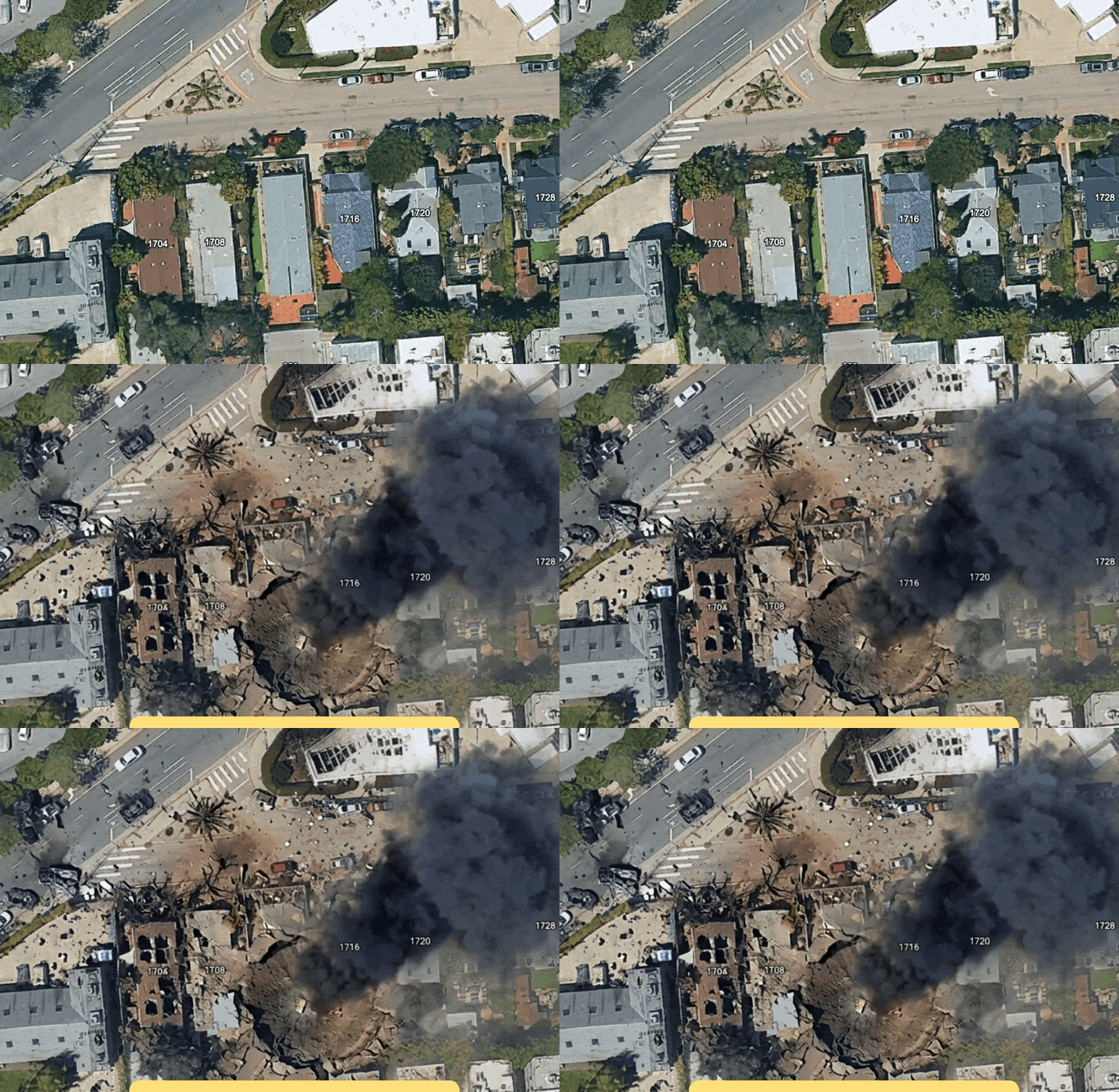
On Thursday, Google introduced a new AI feature into Google Earth which lets anyone fabricate all sorts of misleading or straight up inaccurate satellite imagery, from making it look like a specific place has suffered a drone strike to manifesting a nuclear plant in Iran.
Usually, Google Earth is an exceptionally useful tool for open source intelligence (OSINT) analysts to digitally monitor areas of interest and see how they change over time, say, during a conflict or disaster. Now, Google Earth can easily be used as a tool for disinformation.
💡
Do you work at Google? I would love to hear from you. Using a non-work device, you can message me securely on Signal at joseph.404 or send me an email at joseph@404media.co.
This post is for paid members only
Become a paid member for unlimited ad-free access to articles, bonus podcast content, and more.
Subscribe
Sign up for free access to this post
Free members get access to posts like this one along with an email round-up of our week's stories.
Subscribe
Already have an account? Sign in

