


Text | Sleepy.txt
There have been several large-scale geographic data collection efforts in human history, each of which changed the balance of power.
During the Age of Exploration, Portugal and Spain sent fleets to create nautical charts. Whoever mastered the accurate routes gained the initiative in trade and colonization.
During World War II, the U.S. Army Corps of Engineers created military maps covering the globe. Eisenhower later said that the Allies' ability to win was partly due to the maps.
During the Cold War, the United States and the Soviet Union used spy satellites to photograph each other's territory, and image analysts spent their days staring at blurry satellite photos, counting the number of missile silos on the other side.
These three actions share a common point: they are all state actions, conducted in secrecy, and require huge military budgets, while ordinary people remain completely unaware.
In the summer of 2016, 500 million people voluntarily picked up their phones, walked into parks, took to the streets, and entered shopping malls, using cameras to scan everything around them while playing a game called Pokémon Go. Unbeknownst to them, they were participating in the largest, lowest-cost, and most efficient geographic data collection operation in human history. Each time they stepped out, they were voluntarily uploading ground perspective images of global buildings to the server.

The founder of this game, John Hanke, initially only wanted to create a fun AR game when he started Pokémon Go. However, ten years later, he made another choice, allowing this data to flow into AI and military applications.
Behind this choice lies a chilling clue: the first money Hanke received when he started in 2001 came from the CIA.
The CIA's first money and a young man's dream of maps.
In 1996, John Hanke obtained his MBA from the Haas School of Business at the University of California, Berkeley, and then did something that seemed quite reckless at that time: start an internet venture.
His first company was called Archetype Interactive, which developed a role-playing online game called (Meridian 59), one of the earliest 3D online games in history, nearly a decade before (World of Warcraft). This company was later acquired by 3DO, and Hanke made his first fortune.
In 2001, he founded Keyhole.
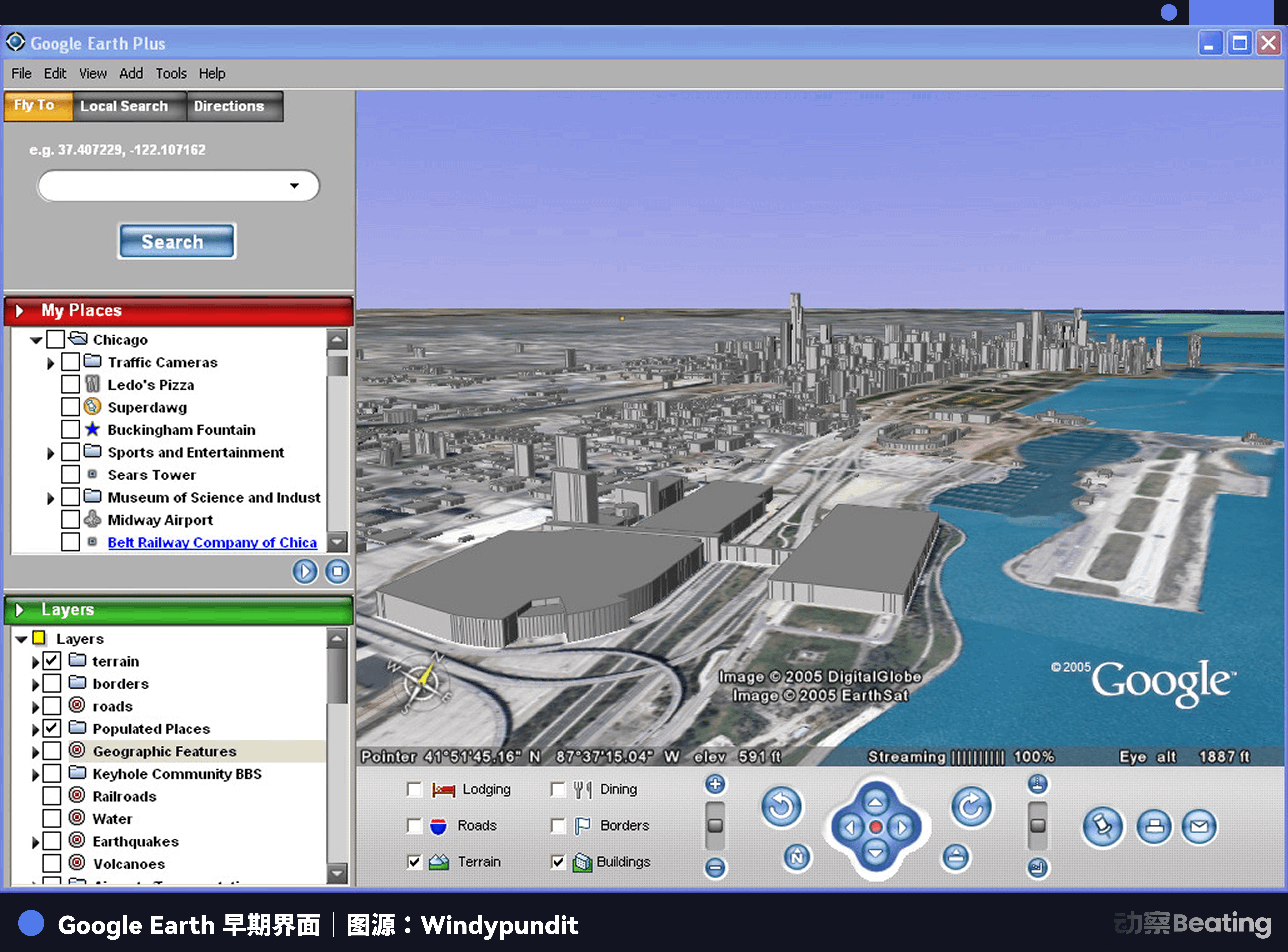
He had a vision for this company: he wanted to stitch satellite images together into an interactive globe, allowing anyone to see any corner of the Earth on their computer screens. At that time, the average internet speed for American households was 56Kbps, and it took half a minute to load a high-definition image. The technology difficulty of Keyhole's product, which needed to stream satellite images in real time, is self-evident.
But one institution immediately recognized its value: CIA's venture capital firm In-Q-Tel.
In-Q-Tel was founded in 1999, personally pushed for establishment by CIA Director George Tenet. Its operational logic has never been about making money, but rather about enabling intelligence agencies to introduce cutting-edge civilian technologies into the intelligence system through commercial investments.
At that time, satellite images could only see the top, while intelligence analysis required ground perspectives, such as the sides of buildings, street layouts, entrance and exit locations, and the shielding conditions of surrounding environments. What Keyhole was doing precisely met this demand.
In the weeks leading up to the Iraq War in 2003, In-Q-Tel completed its investment in Keyhole. Soon, Keyhole's technology was used for battlefield situation analysis, with military analysts using it to study Baghdad's street layouts and the architectural structures of Saddam's palaces.
In October 2004, Google acquired Keyhole for tens of millions of dollars. Keyhole's core technology became what would later change the world: Google Earth. Hanke himself entered Google as the Vice President of Geospatial Products and began to lead a larger project.
Almost at the same time, Peter Thiel, having earned several tens of millions of dollars from selling PayPal, founded a company called Palantir. The company’s name comes from a crystal ball in Tolkien's (The Lord of the Rings). Palantir's idea is to help intelligence agencies find traces of terrorists in massive amounts of information through big data analysis.
While mainstream venture capital in Silicon Valley sneered at it, In-Q-Tel also became one of Palantir's earliest endorsers and investors, and the CIA itself became Palantir's first customer.
The 'mistakes' of street view cars are linked to a culture of first collecting data and then apologizing.
After joining Google, Hanke led the controversial street view project that later sparked global debate.
This is the first attempt in human history to use cameras to record streets worldwide. Google designed a special car equipped with a 360-degree camera array on top, which has been driving around the world since 2007, covering more than 60 countries and capturing billions of photos. These photos were stitched together to create continuous street views, allowing anyone to walk into any street on Google Maps.
This is a product that has changed the way humans perceive space. But in 2010, a scandal completely changed the public's perception of this project.
The Hamburg data protection authority discovered during an inspection that these street view cars were secretly intercepting Wi-Fi data packets from families and businesses along the way while capturing streets. The intercepted content was a complete data stream, including passwords, email content, medical records, bank information, and even the webpages users were browsing.
This action violated communication privacy laws in many countries, including Germany, France, Australia, the UK, Canada, and Spain. Google faced huge fines globally, the U.S. Federal Trade Commission launched an investigation, and the U.S. Department of Justice also got involved. Ultimately, Google paid $7 million in settlement in the U.S., was fined €100,000 in France, and paid fines in Germany, Australia, and other places.
Faced with irrefutable evidence, Google's official explanation was "technical error." An engineer named Marius Milner "accidentally" introduced data interception capabilities in the code, while management was completely unaware.
This code ran on hundreds of cars worldwide for three whole years, collecting data from over 30 countries, with no one reporting internally and no management personnel halting it. The U.S. FCC's investigation report later revealed that Milner had clearly described the functionality of this code in internal documents, which were distributed to multiple Google engineers.

Pulling down this veil, you will see the true Silicon Valley consensus: the bottom line of data is never a physical barrier, but rather a malleable clay that they can secretly manipulate at will. The cost of being discovered is an apology and a fine that is a drop in the bucket for Google, and then it continues.
What is more notable is Google's handling of this incident. It refused to submit complete data content to regulatory agencies in various countries, preventing direct investigation into Milner on the grounds of "engineers' personal privacy," and after investigations in multiple countries concluded, it still retained this batch of data for years.
Armed with this rogue logic of first crossing boundaries to plunder and then spending money to buy forgiveness, Hanke began to think about leaving Google around 2010 to start afresh.
Pikachu is the bait; data is the prey.
In 2015, Hanke officially founded Niantic. The company initially incubated within Google starting in 2010, later became independent, and received $30 million in funding from Google, Nintendo, and the Pokémon Company.
On July 6, 2016, Pokémon Go launched. Within a week, daily active users exceeded 21 million, surpassing Twitter's daily active users. After 60 days, downloads surpassed 500 million. In the United States, this game’s daily active users once exceeded those of Google Maps.
People ran through parks like they were possessed, stood at intersections like wooden stakes, shoving their phone cameras into every corner of their surroundings just to catch that Pikachu on their screens. This madness even evolved into absurd farce, with some people jumping into other people's backyards to catch Pokémon, others crashing into trees while staring at their screens while driving, and even a clueless individual going to the New Zealand police station asking if he could go in to catch a Pokémon.
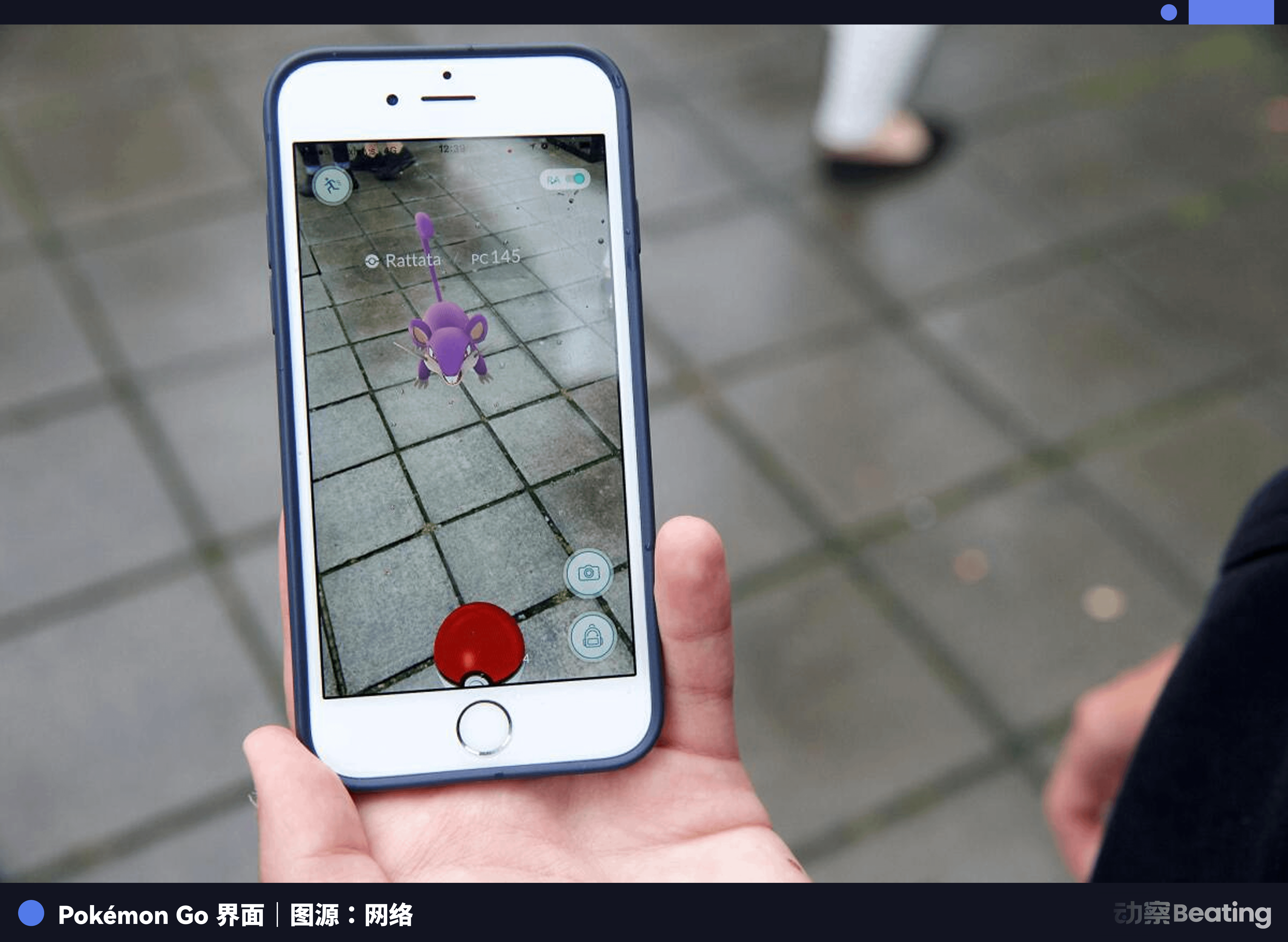
However, if you break down each core mechanism of the game, you will find that every design in this mechanism maximizes the collection of user sensor data.
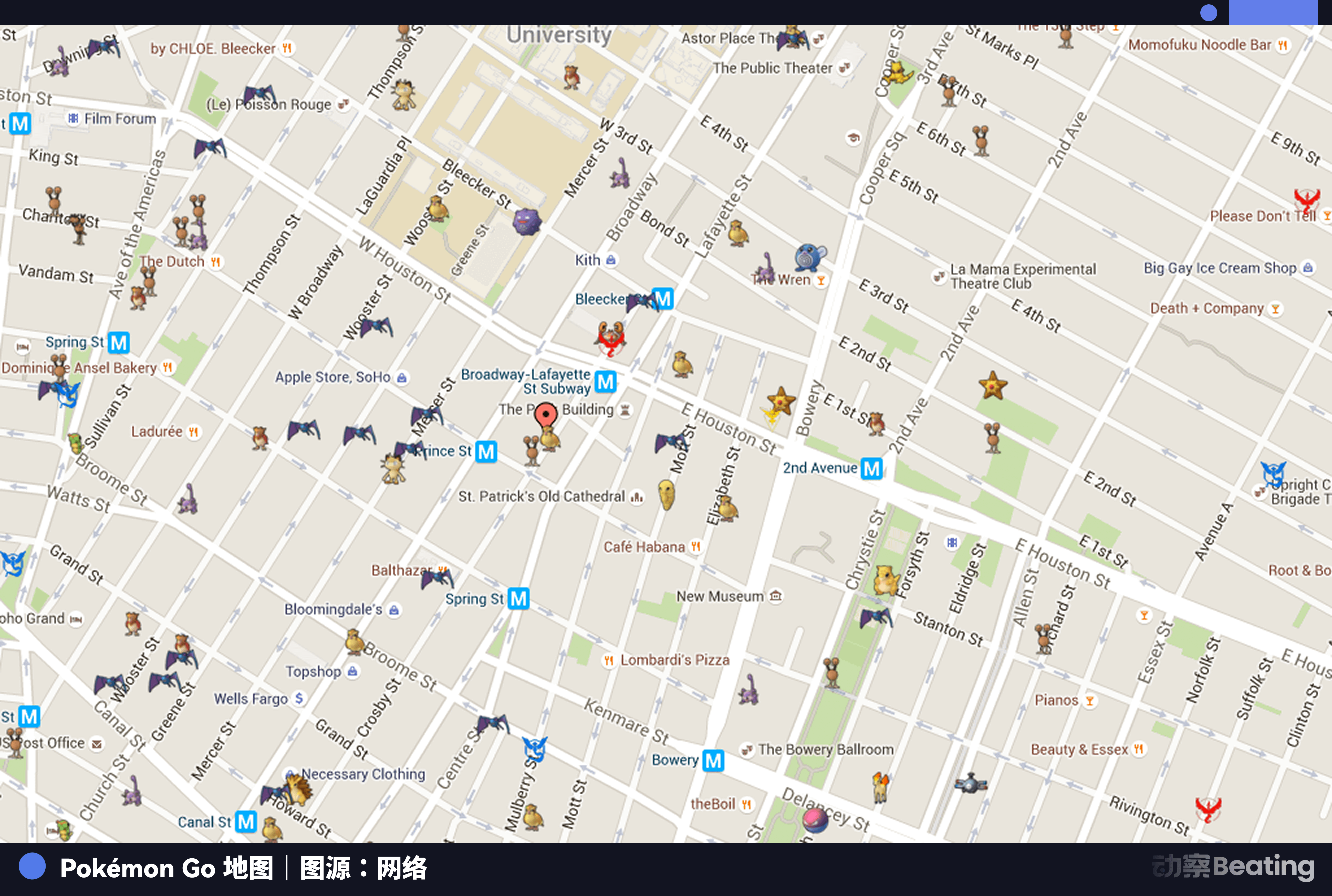
Tasks in the game will direct players to specific locations to scan buildings with their cameras; Pokémon nests encourage players to repeatedly visit the same place, helping the system build multi-angle 3D models of that location; gym mechanisms encourage players to stay for extended periods, collecting detailed data about indoor and surrounding environments; AR mode directly calls the camera, overlaying virtual IPs on the real environment while simultaneously capturing images of the real scene.
Every capture uploads not just a photo, but a complete sensor data packet that includes GPS coordinates, phone orientation, elevation angle, and speed. This data is uploaded in real-time to Niantic's servers, processed, and gradually stitched into a detailed global geographic database.
Niantic calls this system the "Real World Platform." Undeniably, it has provided billions of players with an unprecedented AR entertainment experience. However, in the underlying logic of commerce and technology, this globally popular game objectively serves as the most efficient geographic data collection network in human history. Players chase childhood dreams, while the system quietly harvests essential spatial coordinates to build a digital twin world.
In the early days of the game, the iOS version even quietly requested full access to the user's Google account, theoretically allowing it to read all user emails, Google Drive files, and search histories. This permission, after being publicly disclosed by security researcher Adam Reeve, drew the attention of the U.S. Congress. Senator Al Franken sent Niantic a formal inquiry letter asking why such broad permissions were necessary. Niantic subsequently revoked this permission, with the explanation still being the familiar "technical error."
At that time, governments around the world reacted surprisingly quickly, with many countries directly banning the game. The judgments of these countries were ridiculed by some media as conspiracy theories back then. But today, they seem to have realized earlier than others that a game that encourages 500 million people to voluntarily hold up cameras to scan global buildings is essentially the largest geographic data collection machine in human history.
Moreover, the operating costs of this machine are entirely borne by the users, including data fees, electricity, phone depreciation, and the time and effort spent walking.
Peel away the game shell, leaving a data gold mine, and then sell it to the battlefield.
By 2025, Hanke sold Pokémon Go.
The buyer is the gaming company Scopely, while the real funder behind Scopely is the Saudi sovereign fund PIF. PIF is the sovereign wealth fund led by Saudi Crown Prince Mohammed bin Salman, managing assets exceeding $700 billion, making it one of the largest sovereign wealth funds in the world. Its investment portfolio includes Uber, Lucid Motors, Nintendo, and shares in various Western tech companies.
This transaction means that the historical location data accumulated by hundreds of millions of players over nine years now points to Riyadh.
Why would the Saudi sovereign fund spend $3.85 billion to buy a mobile game whose daily active users had significantly declined from its peak?
The answer may not lie in the game itself, but in the global location data network that underpins the game. Pokémon Go's player data contains the fine movement trajectories of hundreds of millions of people over the past nine years—their residences, workplaces, daily routes, and how long they stayed in various buildings. This is a data set that any advertising company, intelligence agency, or urban planning department would dream of.
But the most ingenious aspect of this transaction lies in what Niantic did not sell.
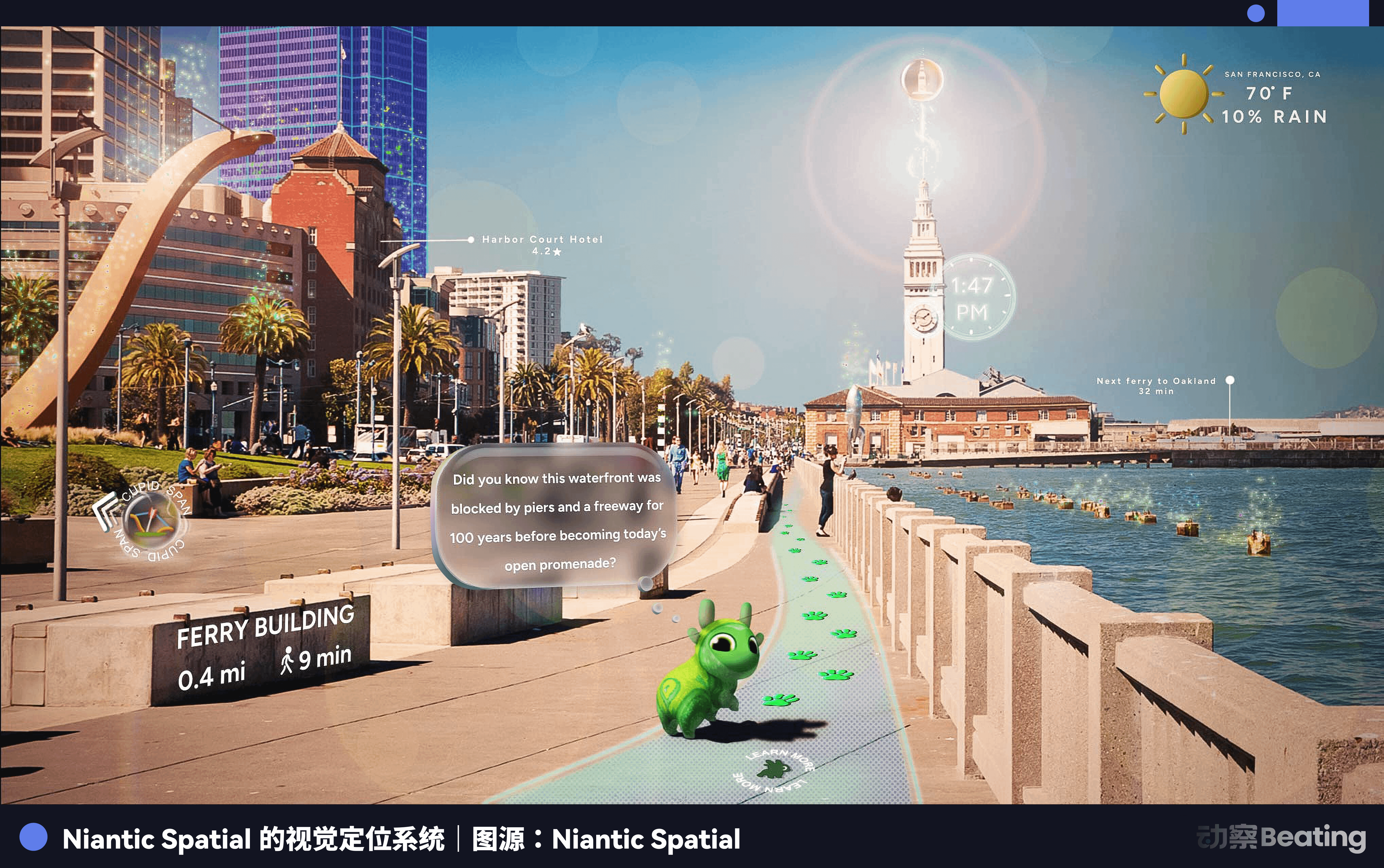
Hanke retained those 30 billion images, the geographic database optimized over nine years, and the large geospatial models trained on this data. He used these assets to establish a new company, Niantic Spatial, and publicly announced a partnership with the delivery robot company Coco Robotics in March 2026. Coco's robots use Niantic Spatial's LGM for centimeter-level precision visual positioning while delivering food on the streets of Los Angeles and Dallas, accurately navigating even in urban canyons where GPS signals are unstable.
But commercial robots are merely a civilian showcase of this technology.
In December 2025, Niantic Spatial signed a cooperation agreement with defense company Vantor to use LGM for military drone navigation in GPS denial environments.
The so-called "GPS denial environment" is an increasingly common state on modern battlefields, where electronic warfare methods disrupt or deceive GPS signals, rendering satellite navigation-dependent weapon systems ineffective. On the battlefield in Ukraine, Russian GPS jamming devices have caused many drones to lose their direction. Vantor's solution is to have drones "see" the ground using cameras and confirm their position by comparing it with ground visual features stored in LGM.
The ground visual features stored in LGM come from the 30 billion images captured by Pokémon Go players.
A complete chain has finally surfaced. The map company funded by the CIA has transformed into the largest ground visual data collection game globally, and this data is used to train AI's geospatial models, ultimately becoming the navigation system for military drones.
At the same time, Alex Karp, CEO of Palantir, which was also incubated by the CIA, publicly stated without hesitation that AI was reshaping the nature of modern warfare. Palantir's AI platform, AIP, has been deployed on the battlefield in Ukraine to assist the Ukrainian military with target identification and strike decisions. In Gaza, Palantir's system has been used by the Israel Defense Forces for intelligence analysis.
The two seeds planted by intelligence capital in Silicon Valley, Hanke and Thiel, one collecting data from the physical world and the other analyzing data from the digital world, met twenty years later at the endpoint of AI militarization.
No one has ever told you these things.
In 2025, Hanke published an article on the official blog of Niantic Spatial, titled (The Future $10 Trillion AI Investment Should Flow to the Physical World).
His logic is that large language models have already taught AI to speak, but if AI is to truly enter the real world, such as driving cars, controlling robots, or acting autonomously in cities, it needs one more thing: spatial perception of the physical world. Niantic Spatial aims to become the Google Maps of the AI era, a physical world coordinate system shared by all robots and AI agents.
This vision sounds completely legitimate. But it conceals a premise that no one has ever publicly clarified: the data from this coordinate system comes from 500 million ordinary users who have never consented to use their location data for military applications.
In 2016, the privacy terms you agreed to when registering for Pokémon Go stated, "We may share data with third-party partners to improve services." No one knew who these partners were, where the boundaries of "sharing" lay, and no one anticipated that "improving services" would ultimately include helping drones navigate on the battlefield.
When this batch of data flows into military applications, not a single regulatory agency intervenes, not a single user is notified, and no national legal framework can trace this data flow chain.
Here is a comparison that is worth our serious consideration. The U.S. government demanded ByteDance to forcibly divest TikTok's U.S. operations on the grounds that "data might be obtained by the Chinese government," and held a lengthy congressional hearing. However, when Pokémon Go's data was sold to the Saudi sovereign fund and used for military applications, the U.S. government remained silent. The logic behind this double standard has never been about data security, but rather geopolitics. The security of data depends on whose hands it flows into.
The deeper issue is that this is not just a problem with Pokémon Go. Meta's smart glasses are continuously scanning the user's environment, Apple's Vision Pro is building indoor 3D maps, and Waymo's self-driving cars are reconstructing detailed models of urban roads. These data collection activities are not fundamentally different from Pokémon Go. In the AI era, every consumer-level device with a camera is a potential geographic data collection node, and users are almost completely unaware of it.
Now, it is time to thoroughly penetrate this hidden commercial dark web.
In the summer of 2016, an ordinary person raised their phone to catch a Pikachu and inadvertently scanned the wall of a building.
This casually taken photo was silently uploaded to the server, along with another 30 billion similar photos, training a large geospatial model.
Then, this model was packaged into a new shell called Niantic Spatial; don't forget, the funding for this company originally came from the CIA.
Today, it serves as an electronic eye for killing drones that have lost GPS signals on the battlefield.
And that game itself has long been valued at $3.85 billion, sold to the Saudi sovereign fund that is keen on transnational surveillance.
When broken down, every link in this利益 chain is clean enough to find no fault, all within the compliance framework. But once tightly interlocked, it becomes a Leviathan that no law can restrain.
This may be the most thought-provoking paradox of the digital age. A system that operates in the sunlight and conforms to commercial compliance logic, driven initially by people's pursuit of pure joy, might ultimately become part of a cold war machine under the constraints of capital and geopolitical pressures.
Perhaps Hanke initially just wanted to create a good game, but under the gaze of intelligence capital, this data inevitably flowed to the most profitable and bloody outlets. Hanke did not lie; he merely swallowed the bloodiest half of the sentence. And those omitted lines are now crossing over the horizon of some battlefield, transforming into guided bombs that tear through the air with a wail.
At 10:45 AM on February 28, 2026, a wailing sound appeared in the city of Minab, Hormozgan Province, Iran.
A U.S. Tomahawk cruise missile accurately struck the Shajareh Tayyebeh girls' school in the area, causing two teaching buildings to collapse instantly, resulting in the deaths of 175 people, mostly girls aged 7 to 12. This school is adjacent to the Iranian Revolutionary Guard's naval base and was once military property of the Iranian Revolutionary Guard before being converted into a school. However, in the eyes of the Pentagon's target identification systems driven by Palantir and top AI, it remained a military stronghold that needed to be eliminated.
No one knows if there is a fatal architectural feature in this massive database that has determined the lives and deaths of nearly 200 people, which was collected for free by some ordinary person holding a camera on the street ten years ago. But what we know is that in this meat grinder welded shut by countless cameras, Silicon Valley data dealers, and the military-industrial complex, the spring medicine of "technology for good" has long lost its effect. It ultimately delivers only cold, blind, and precisely guided death to the real world.


