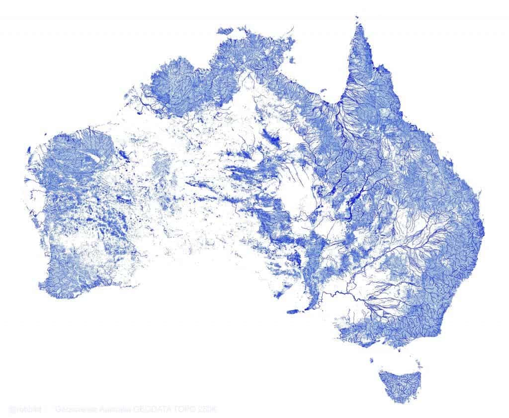
They say Australia is the Dry Continent, but you wouldn’t guess that based on this image:
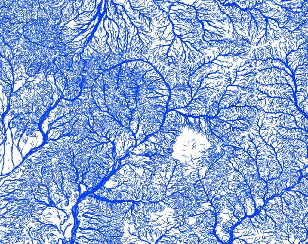
The image was created with QGIS using data for 1.3 million streams from Geoscience Australia GEODATA TOPO 250K vector datasets [GitHub code]. This is North-west Queensland:
… and the North-east Murray-Darling Basin:
But there’s a catch: not all these rivers are permanent ones
×
Get smarter every day...
Stay ahead with ZME Science and subscribe.
Thank you! One more thing...
Please check your inbox and confirm your subscription.
“Many arid-zone rivers and streams in these maps are highly ephemeral, and may only flow once every few years or even decades. Streams are weighted by both ephemerality (perennial or non-perennial) and hierarchy (minor or major), with the highest weighting for major perennial rivers (i.e. Murray River),” the agency writes.
The map without the ephemeral rivers does indeed look much more barren, and I’m almost wondering if there’s something missing from this map.
Dr. Andrei Mihai is a geophysicist and founder of ZME Science. He has a Ph.D. in geophysics and archaeology and has completed courses from prestigious universities (with programs ranging from climate and astronomy to chemistry and geology). He is passionate about making research more accessible to everyone and communicating news and features to a broad audience.
A team of NASA researchers has developed the first ever method for identifying and studying underground forest fungi from outer space, providing information that will help us better understand how forests will develop.
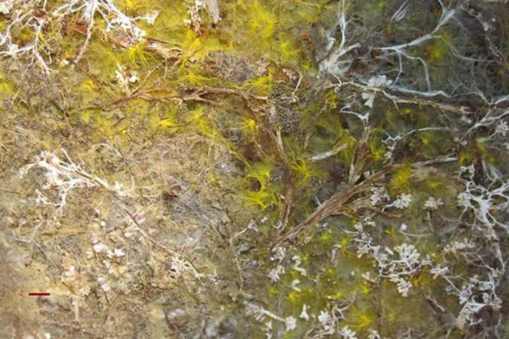
Mycorrhizal fungi (white/yellow) trading nutrients for carbon with tree roots (brown). Credits: Indiana University / NASA
Mycorrhizal fungi (underground fungus) are more similar to a city network than to individual organisms. They are complex intertwined networks that can spread for miles and miles in the search for nutrients. You can find such a fungal network under most of the world’s forests, and there is a special type of relationship between it and trees. The fungus trades nutrients that trees need with the sugars that the trees make during photosynthesis, in an almost symbiotic fashion.
“Nearly all tree species associate with only one of two types of mycorrhizal fungi,” explained coauthor Richard Phillips of Indiana University, Bloomington.
The thing is, this type of relationship is extremely vulnerable in the face of climate change. Knowing which type of fungus is predominant will help researchers predict where forests will thrive and where they will falter. Creating this type of map is a difficult and time-consuming endeavor, and only works at small scales. With the technique NASA developed, it works much faster, cheaper, and on much larger scales. Joshua Fisher, who also authored the study, found a way to detect this hidden network using satellite images.
The method relies on a spectral analysis; every tree species has its own “spectral fingerprint”, it absorbs and reflects light in a specific way, across all wavelengths of the light spectrum. Using satellite images of forest canopies, Fisher’s group probed whether they could identify any patterns in the spectral signatures of tree species associated with one type of fungus that did not appear in species associated with the other type.
“Individual tree species have unique spectral fingerprints, but we thought the underlying fungi could be controlling them as groups,” he said.
They applied the technique to four U.S. forest research plots that are part of the Smithsonian Institution’s Forest Global Earth Observatory. The area includes 130,000 trees across 77 species, and the tree species associated with each type of fungus had already been mapped from the ground. The team then analyzed images of the forest canopies taken by the NASA/U.S. Geological Survey Landsat-5 satellite from 2008 to 2011 in many different ways, looking for similarities with the fungus pattern. They found different patterns in different times of the year establishing timing sequences related to each type of fungus, correctly predicting fungus evolution (and implicitly, forest evolution) in 77% of all cases. Fisher concludes:
“That these below-ground agents manifest themselves in changes in the forest canopies is significant. This allows, for the first time, some light to be shed on their hidden processes.”
Dragos has been working in geology for six years, and loving every minute of it. Now, his more recent focus is on paleoclimate and climatic evolution, though in his spare time, he also dedicates a lot of time to chaos theory and complex systems.