

Do we Know We Need to Fight an Offensive War in a Funnel in the Western Pacific?
...looking at the problem from a better perspective...
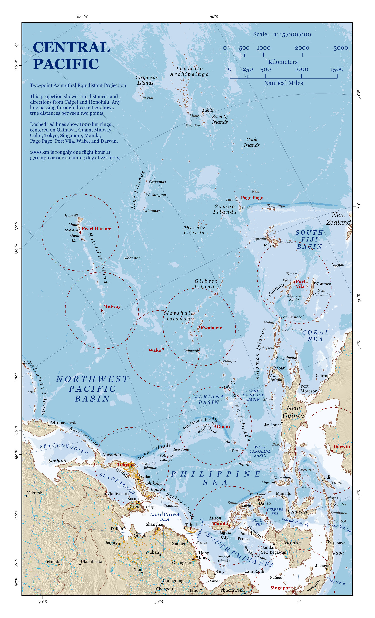
I first saw this map three years ago, and it recently resurfaced in my thoughts.
I remain convinced that a lot of the problem with trying to get everyone to fully understand the challenge in the Western Pacific is that to a large part, we think in a ‘north-up’ orientation.
I don’t think that is all that helpful.
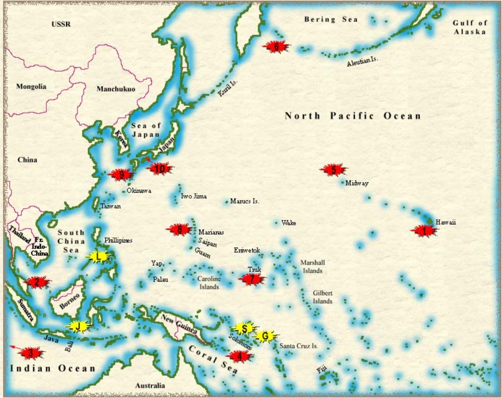
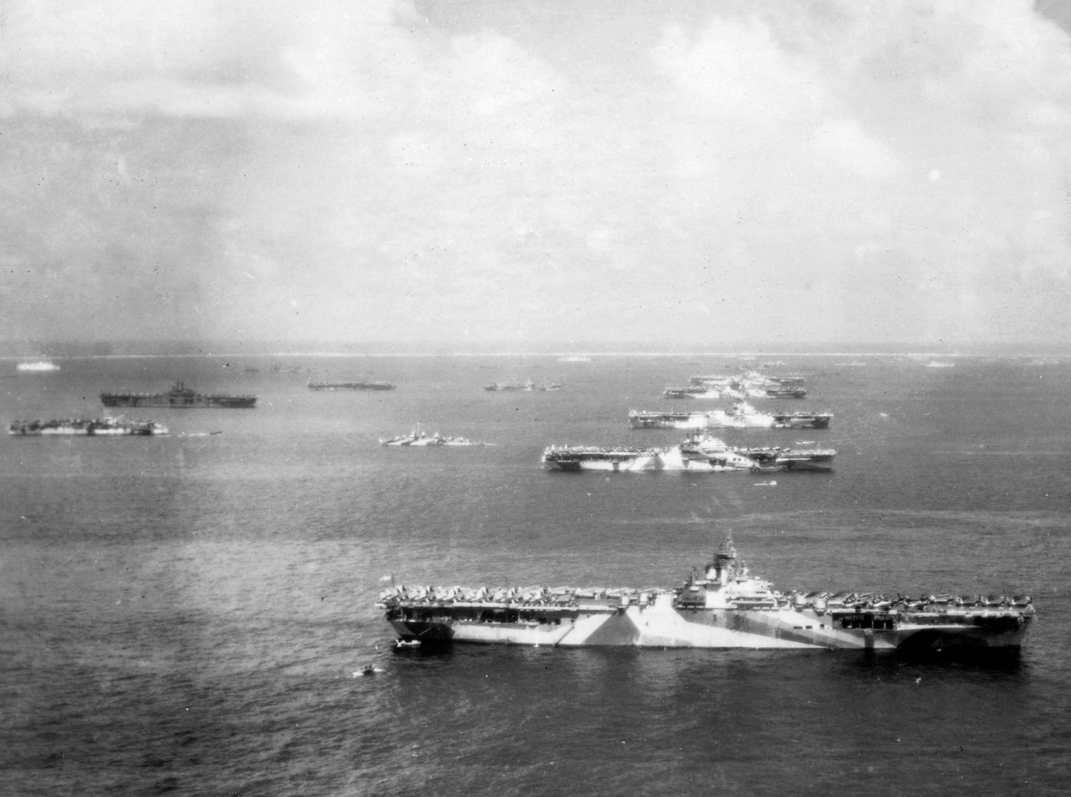
Just a few days ago, we had another Pearl Harbor Day anniversary and we’ve all seen the maps, usually centered on Hawaii, where the Imperial Japanese Navy’s Kidō Butai comes at the Pacific Fleet from stage left off the map. Then we fought battles in the Coral Sea, Midway, and so on.
To the lay eye — or to those who don’t have time to dig into the reasons — a traditional north-up map looks disjointed; things seem all over the place.
No, not really. Let’s bring back that first map.
For both Imperial Japan in the early-mid 20th century and Communist China today, the most important part of this map is the access to the resources in or going through the bottom-right hand corner.
Today’s greatest bone of contention — not unrelated to the most important part of the map mentioned above — is Taiwan, right at the mouth of the funnel.
If we need to bring a fight there, that is one hell of a fight to get there if the People’s Republic of China (PRC) wants to prepare a proper welcome for us.
For the PRC, the primary military threat to plan for comes across the Pacific into a funnel that terminates at its most important SLOC. It’s the United States of America, and the US has a series of islands leading right into the heart of the PRC’s. It starts in Hawaii — Midway, Wake, Guam — and then to U.S. allies: the Philippines, Japan, and Australia.
They’re planning a layered defensive fight. Their actions make that clear.
Make no mistake, we may say we are going to “defend Taiwan”, but to do that we will have to fight an aggressive war across the Pacific, into the enemy’s prepared funnel.
To build up real power, the US and her allies will need Japan, of course, but also Australia and the islands to her north. If you can blunt the Hawaii/Midway/Wake/Guam spear, and then take away any possible southern flanking movement by taking the string of islands from Singapore to Samoa—you can keep the American Navy on their side of the International Date Line—where, in your mind, they belong.
If the PRC can prepare the battlefield in peace, then when war comes, she will be more than just a few steps ahead of your enemy and if anything else, will make any attempt to come to the Western Pacific a costly endeavor even before getting in range of Taiwan and PRC proper.
That is why for a long time we have been beating the drum along with our friends Cleo Paskal, Brent Sadler, and others about the Marshall and Gilbert Islands, brave little Palau, the Caroline Islands, the Federated States of Micronesia … all those islands.
The PRC can read history and look at charts too.
Look at the chart again. What island do you see right between Palau and Guam? That’s right, Yap. Head 110T about 365 nautical miles from there, and you have the island of Woleai. About 1/3 of the way from Yap to Woleai, and slightly north, is Ulithi.
The irreplaceable Cleo is tapping us on the shoulder again.
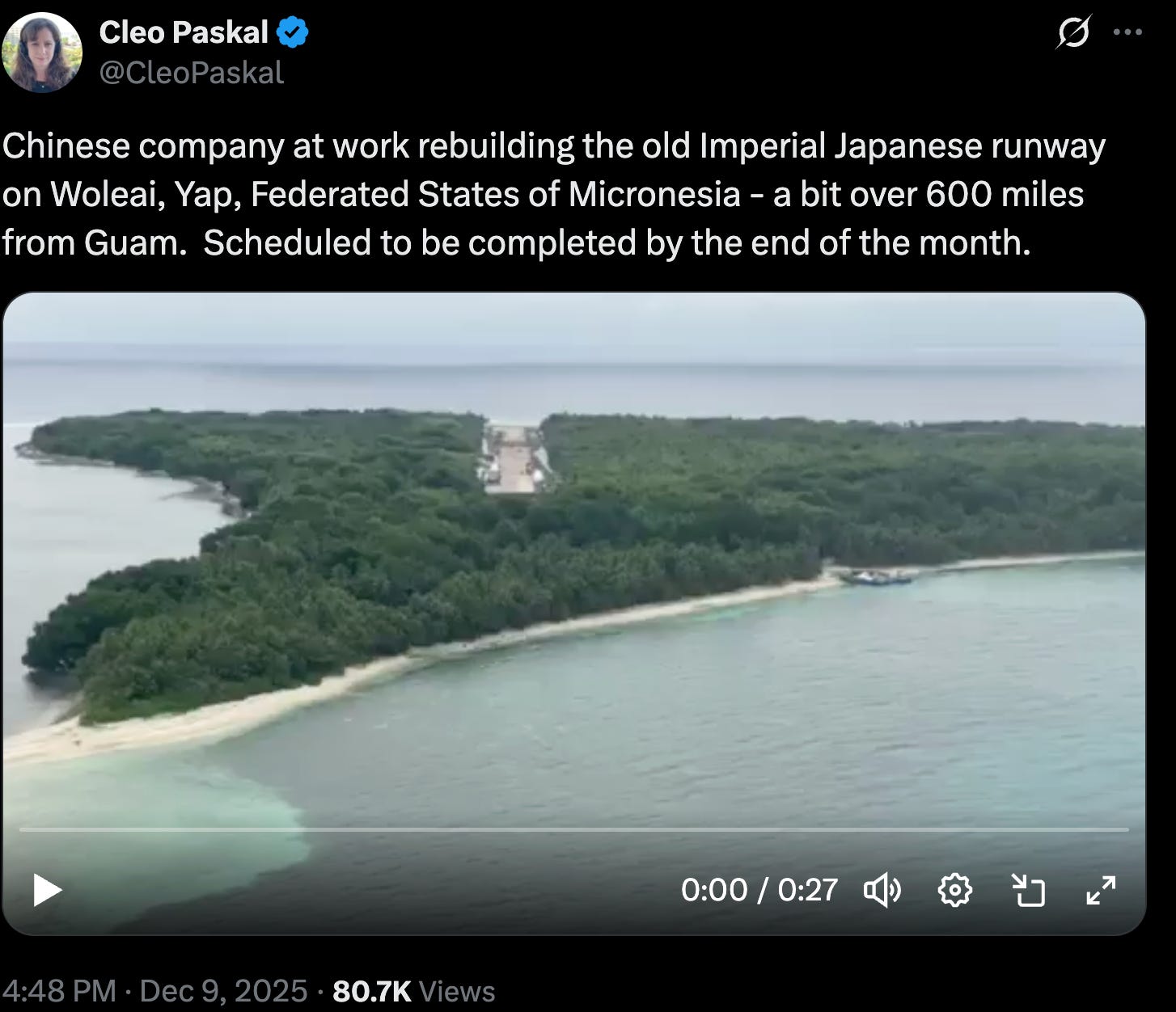
Let me give you the 100,000 foot view.
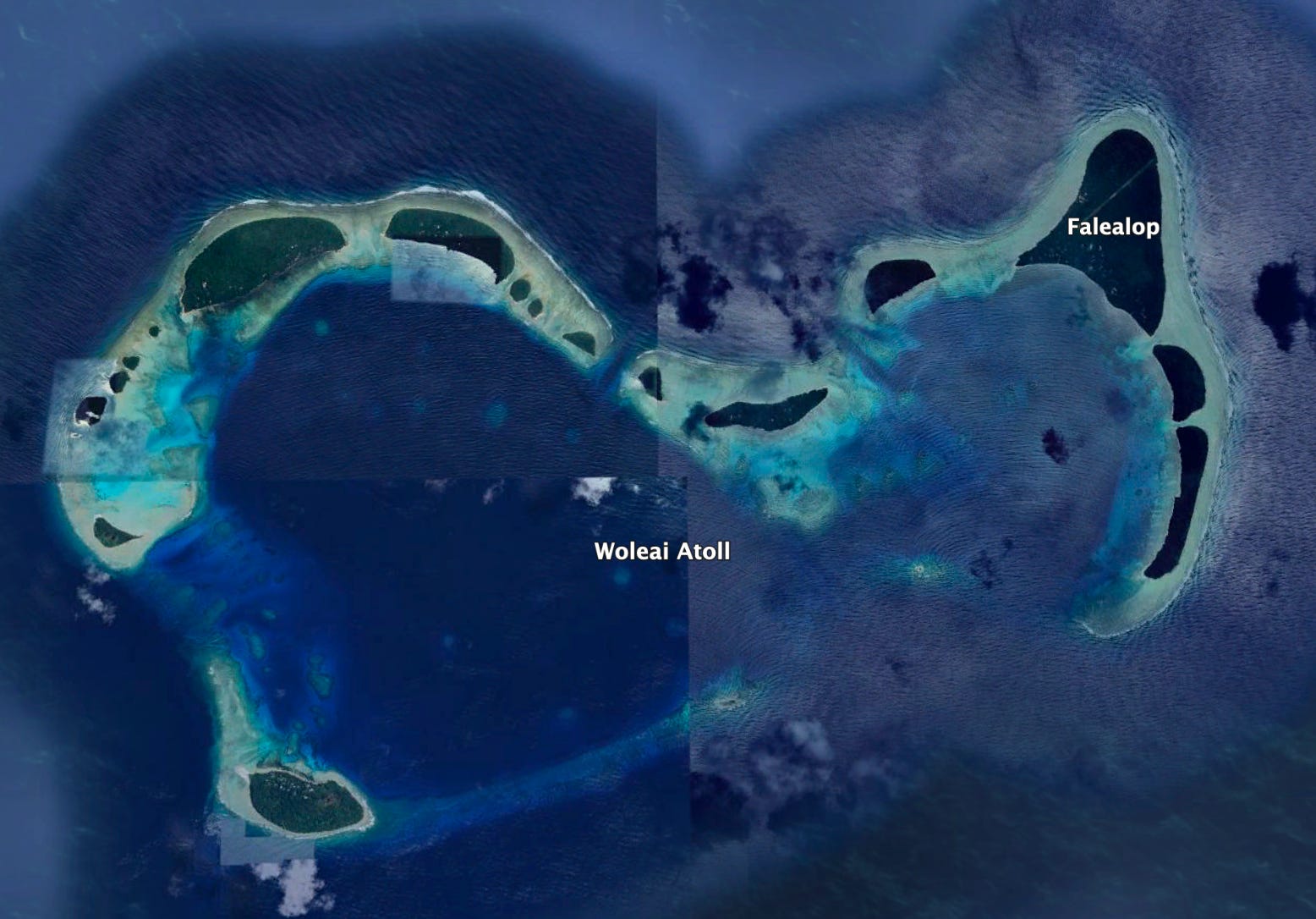
You can barely see the once overgrown Imperial Japanese airfield next to Falealop. It has been inoperable since 1992…the dawn of the Jesus Jones Era.
Oops. History is back, and she’s a bit pissed.
There is no reason to have an airfield there besides why the Imperial Japanese built one…for military purposes. To help control/threaten the approaches to the Western Pacific from the United States. Big difference now is that modern weapons give such bases much more of a reach.
There is no industry there. No prospects for tourism on a disaggregated atoll with only 1,000 souls that would justify that airfield.
Remember what Ulithi meant in the last Great Pacific War?
Tick tock. China is can’t stop, won’t stop.
Are we paying attention?

In 1984 went diving the Japanese wrecks off Palau (Republic of Koror) for a week, then 3 weeks at Truk Lagoon. Neither place had significant industry other than the tourist industry for diving.
There was a USAF Red Horse unit on Truk working sun up to noon, they using a USAF provided ski boat to dive the wrecks. (The big red, white and blue USAF painted across the side of the boat was a hint). I said to my dive buddy then that the US should expand the international airport at Truk and put some supply depots underground in shelters there.
Sadly none of our leadership seems to be able to read history, or understand the blood, sweat and tears we spent fighting our way across the Pacific on these islands, as Commander Sal so eloquently states in this article. Otherwise, we would have started building up dispersed supply depots, runways, and piers as well as stockpiling the missiles necessary to fight a battle like the one shaping up for Taiwan.
CDR Sal, great job of presenting the problem from a different perspective that genuinely makes a difference in how it is perceived. VERY familiar with the intimate details of this, and your map flip I'd offer makes this look a lot more like Kursk on the Eastern Front than our island-hopping campaign in WWII.
Our best hope is to not fight. We will have to resort to an "unacceptable cost" strategy to maintain the status quo unless the SAP / STO wizards can literally pull a rabbit out of the hat for a "win". Or we go nuclear, and all of the potentially world ending uncertainty breaking that seal implies.