Introduction
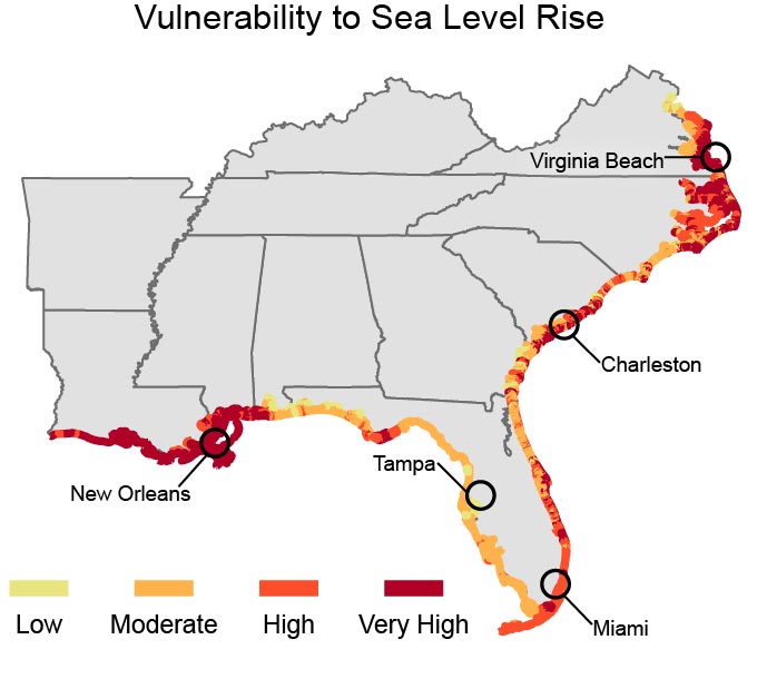
The Southeast and Caribbean are exceptionally vulnerable to sea level rise, extreme heat events, hurricanes, and decreased water availability. The geographic distribution of these impacts and vulnerabilities is uneven, since the region encompasses a wide range of natural system types, from the Appalachian Mountains to the coastal plains.It is also home to more than 80 million people95 and draws millions of visitors every year. In 2009, Puerto Rico hosted 3.5 million tourists who spent $3.5 billion.96 In 2012, Louisiana and Florida alone hosted more than 115 million visitors.97,98
The region has two of the most populous metropolitan areas in the country (Miami and Atlanta) and four of the ten fastest-growing metropolitan areas.95 Three of these (Palm Coast, FL, Cape Coral-Fort Myers, FL, and Myrtle Beach area, SC) are along the coast and are vulnerable to sea level rise and storm surge. Puerto Rico has one of the highest population densities in the world, with 56% of the population living in coastal municipalities.2
 ©Richard H. Cohen/Corbis
The Gulf and Atlantic coasts are major producers of seafood and home to seven major ports3 that are also vulnerable. The Southeast is a major energy producer of coal, crude oil, and natural gas, and is the highest energy user of any of the National Climate Assessment regions.3

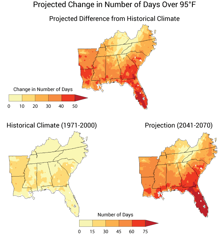
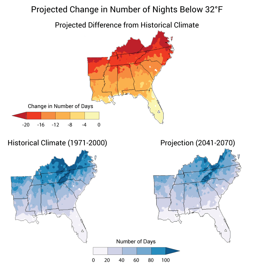
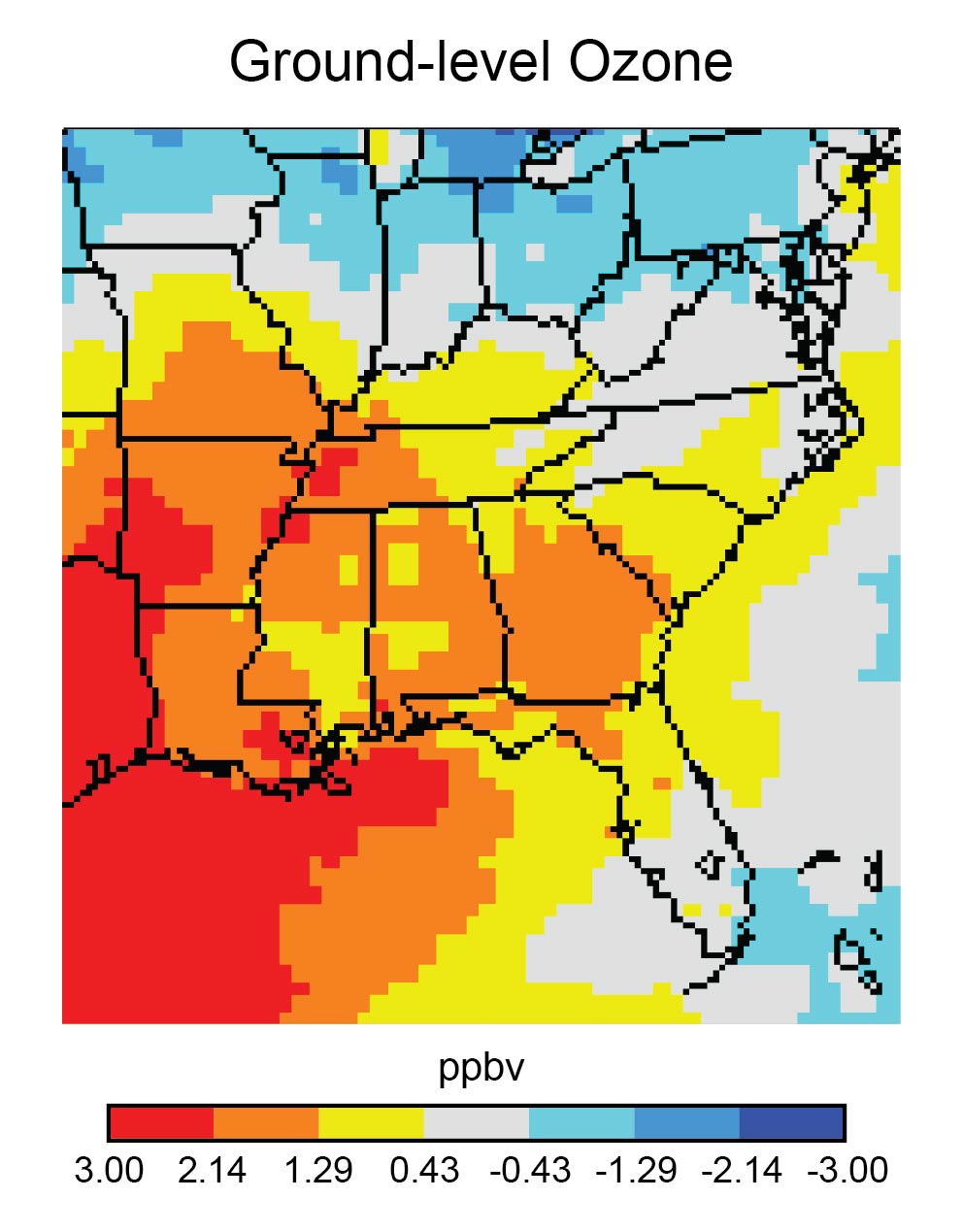
The Southeast’s climate is influenced by many factors, including latitude, topography, and proximity to the Atlantic Ocean and the Gulf of Mexico. Temperatures generally decrease northward and into mountain areas, while precipitation decreases with distance from the Gulf and Atlantic coasts. The region’s climate also varies considerably over seasons, years, and decades, largely due to natural cycles such as the El Niño-Southern Oscillation (ENSO – periodic changes in ocean surface temperatures in the Tropical Pacific Ocean), the semi-permanent high pressure system over Bermuda, differences in atmospheric pressure over key areas of the globe, and landfalling tropical weather systems.99,100,101,102,103 These cycles alter the occurrences of hurricanes, tornadoes, droughts, flooding, freezing winters, and ice storms, contributing to climate and weather disasters in the region that have exceeded the total number of billion dollar disasters experienced in all other regions of the country combined (see Figure 17.1).
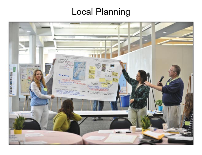
Stories of Change: Coastal Louisiana Tribal Communities
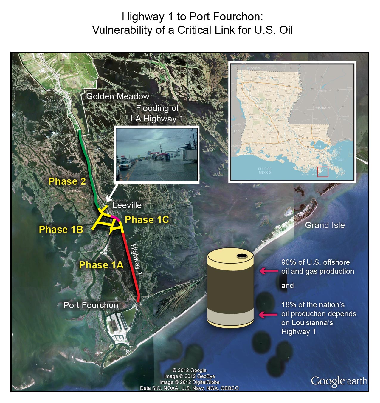
Climate change impacts, especially sea level rise and related increases in storm surges pulsing farther inland, will continue to exacerbate ongoing land loss already affecting Louisiana tribes. Four Native communities in Southeast Louisiana (Grand Bayou Village, Grand Caillou/Dulac, Isle de Jean Charles, and Pointe-au-Chien) have already experienced significant land loss. Management of river flow has deprived the coastal wetlands of the freshwater and sediment that they need to replenish and persist. Dredging of canals through marshes for oil and gas exploration and pipelines has led to erosion and intense saltwater intrusion, resulting in additional land loss. Due to these and other natural and man-made problems, Louisiana has lost 1,880 square miles of land in the last 80 years.13 This combination of changes has resulted in a cascade of losses of sacred places, healing plants, habitat for important wildlife, food security,104 and in some cases connectivity with the mainland. Additional impacts include increased inundation of native lands, further travel to reach traditional fishing grounds, reduced connections among family members as their lands have become more flood-prone and some have had to move, and declining community cohesiveness as heat requires more indoor time.79 (For more specifics, see Ch. 12: Indigenous Peoples). Numerous other impacts from increases in temperature, sea level rise, land loss, erosion, subsidence, and saltwater intrusion amplify these existing problems.
Figure 17.2: Shrinking Lands for Tribal Communities


Figure 17.2: Aerial photos of Isle de Jean Charles in Louisiana taken 45 years apart shows evidence of the effects of rising seas, sinking land, and human development. The wetlands adjacent to the Isle de Jean Charles community (about 60 miles south of New Orleans) have been disappearing rapidly since the photo on the left was taken in 1963. By 2008, after four major hurricanes, significant erosion, and alteration of the surrounding marsh for oil and gas extraction, open water surrounds the greatly reduced dry land. See Ch. 25: Coasts for more information. (Photo credit: USGS).