Perry-Castañeda Library
Map Collection
World Maps

The PCL Map Collection includes more than 250,000 maps, yet less than 30% of the collection is currently online.
A $5, $15, or $25 contribution will help us fund the cost of acquiring and digitizing more maps for free online access.
Click the SUPPORT US button to make your contribution today!
The following maps were produced by the U.S. Central Intelligence Agency, unless otherwise indicated.
- Age Structure - World Age Structure, 2005 and Projected 2025 from Global Trends 2025: A Transformed World [page 40], National Intelligence Council, 2008 (213K)
- Earth as Art Landsat imagery
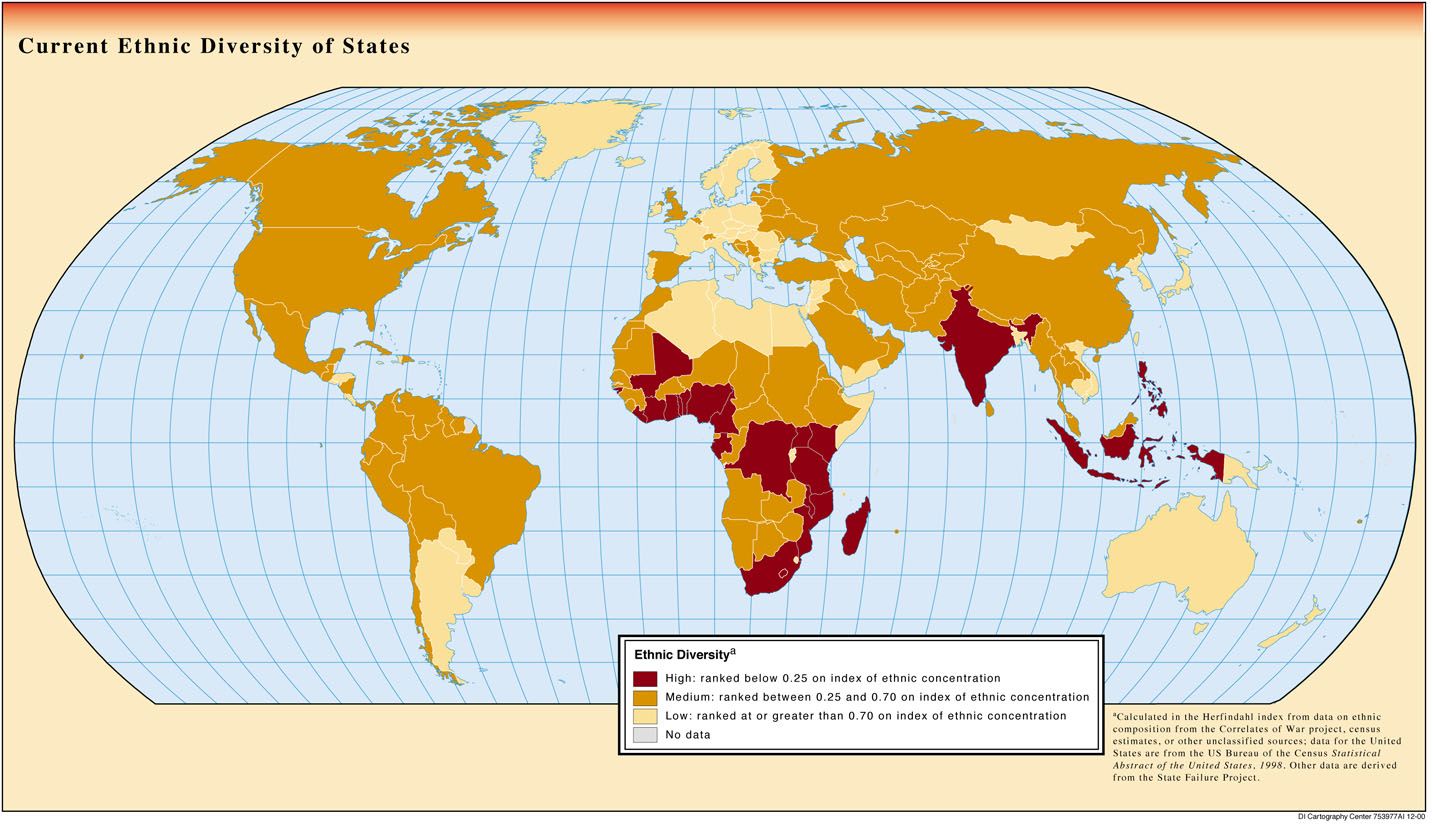
- Ethnic Diversity of States from Global Trends 2015: A Dialogue About the Future With Nongovernment Experts [page 59], National Intelligence Council, 2000 (312K)
- Gross Domestic Product Per Capita from Handbook of International Economic Statistics. 1996 (546K)
- Historical Maps of the World (University of Texas Map Collection)
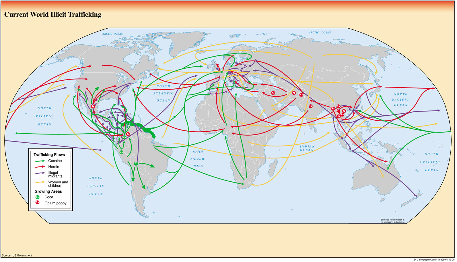
- Illicit Trafficking Routes from Global Trends 2015: A Dialogue About the Future With Nongovernment Experts [page 51], National Intelligence Council, 2000 (312K)
- International Map of the World (topographic maps 1:1,000,000)
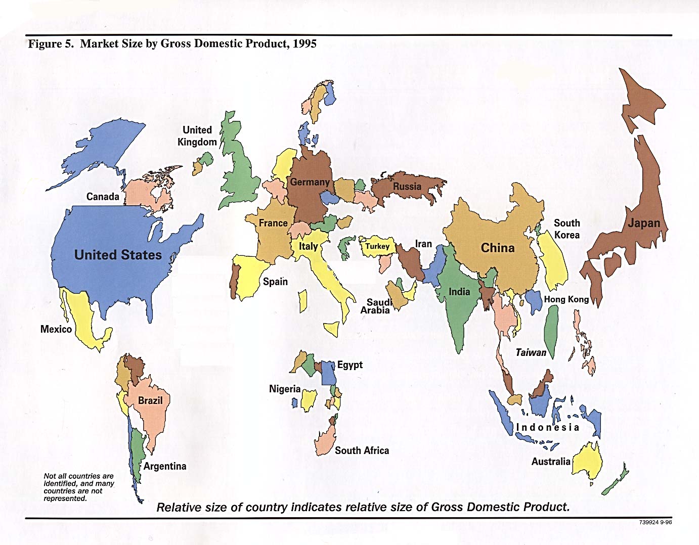
- Market Size By Gross Domestic Product from Handbook of International Economic Statistics. 1996 (215K)
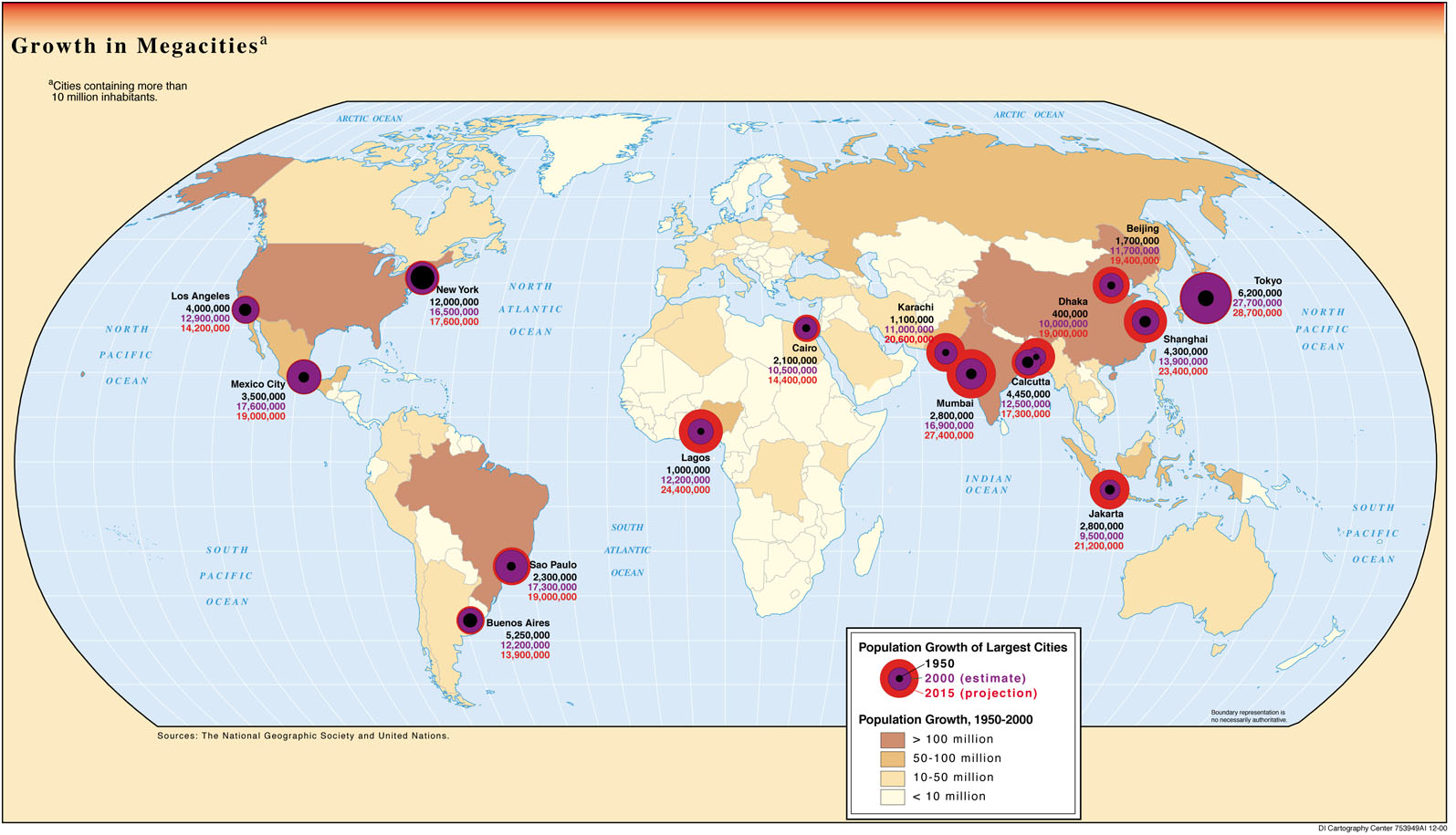
- Megacities - Growth in Megacities 1950-2015 from Global Trends 2015: A Dialogue About the Future With Nongovernment Experts [page 29], National Intelligence Council, 2000 (258K)
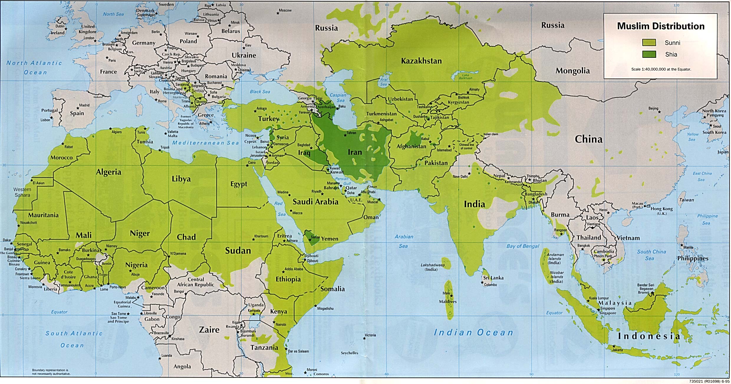
- Muslim Distribution (Sunni and Shia) 1995 (557K)
- Oceans 2015 (2.9MB) [pdf format]
- Oceans 2013 (1.7MB) [pdf format]
- Oceans 2012 (2.5MB) [pdf format]
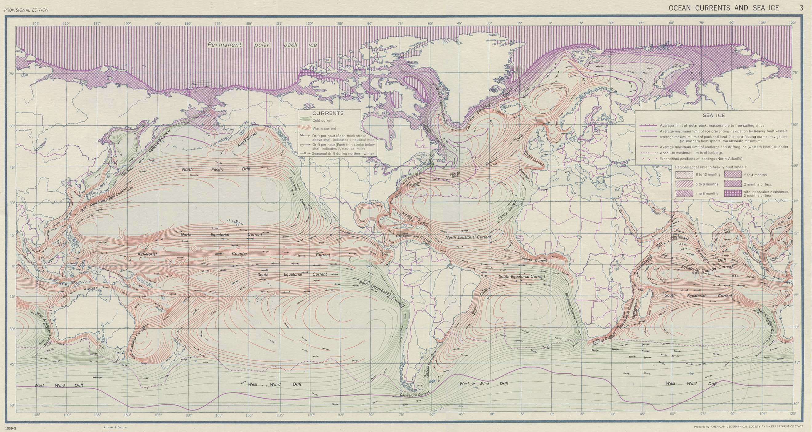
- Ocean Currents and Sea Ice from Atlas of World Maps. United States Army Service Forces, Army Specialized Training Division. Army Service Forces Manual M-101. 1943 (583K)
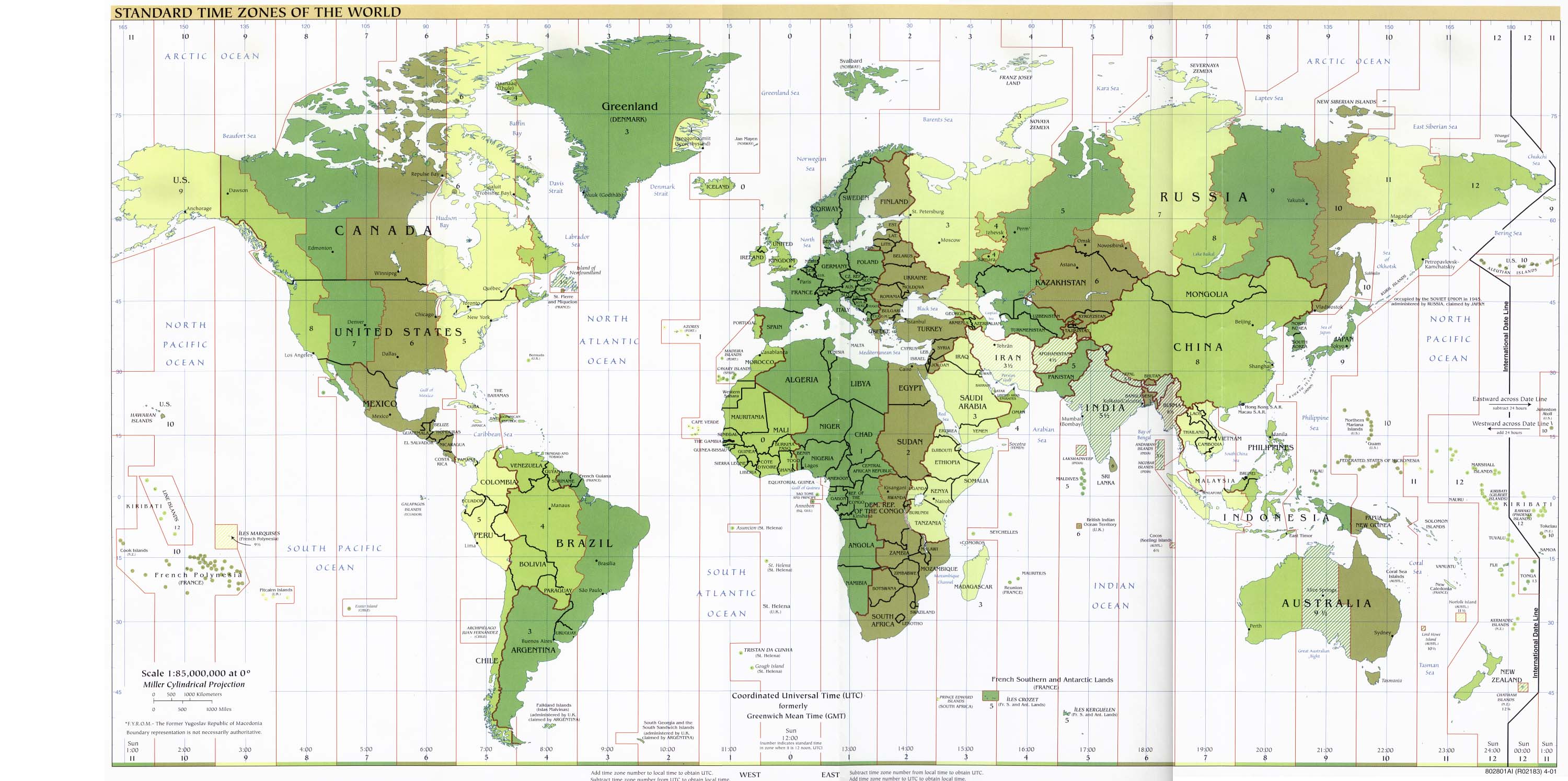
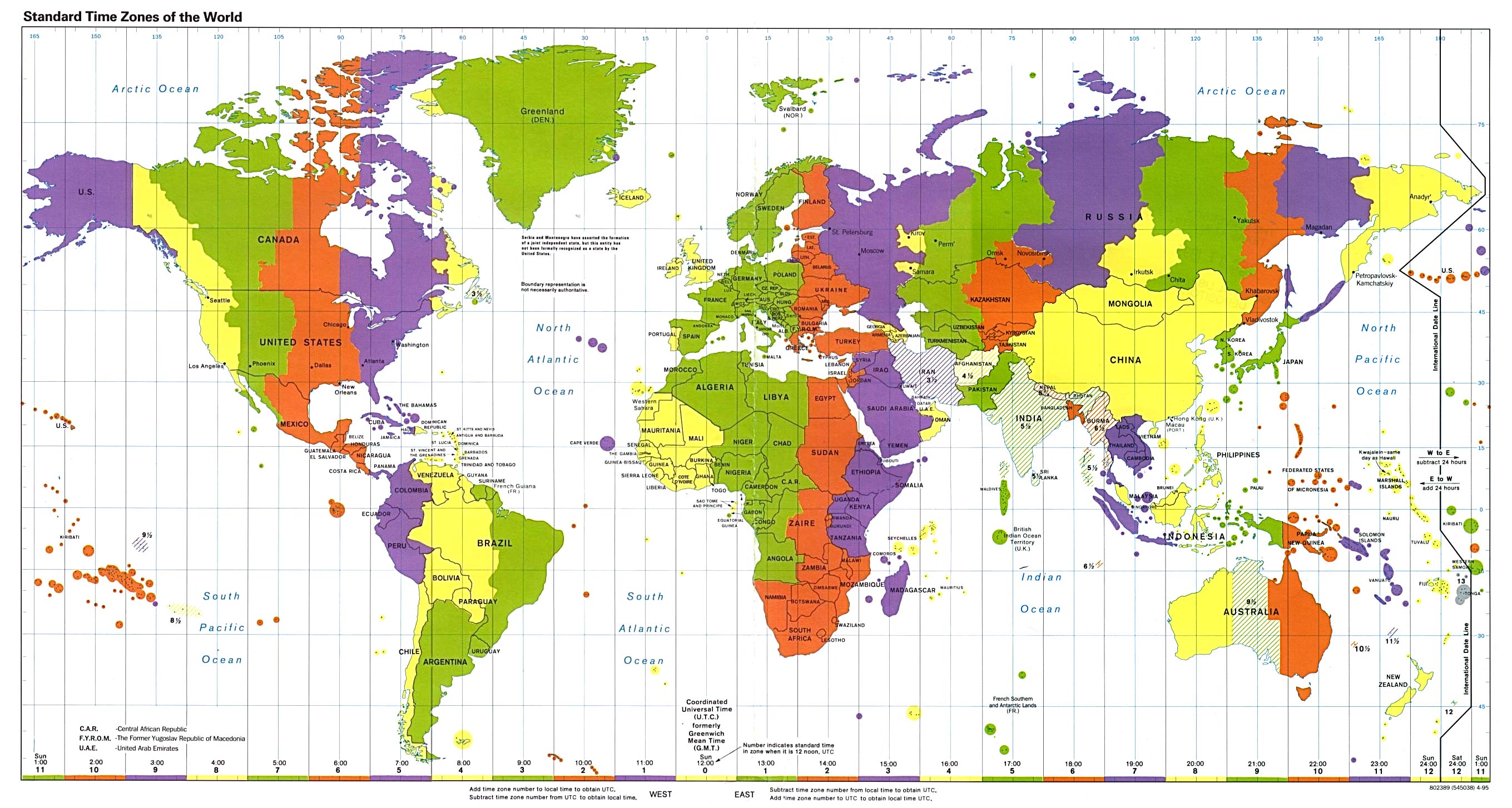
- Standard Time Zones of the World 2015 (3.3MB) [pdf format]
- Standard Time Zones of the World 2013 (3.2MB) [pdf format]
- Standard Time Zones of the World 2012 (867.6K) [pdf format]
- Standard Time Zones of the World 2011 (867K) [pdf format]
- Standard Time Zones of the World 2010 (810K) [pdf format]
- Standard Time Zones of the World 2008 (1.6MB) [pdf format]
- Standard Time Zones of the World 2007 (853K) [pdf format]
- Standard Time Zones of the World 2005 (824K) [pdf format]
- Standard Time Zones of the World 2005 (824K) [pdf format]
- Standard Time Zones of the World 2004 (806K) [pdf format]
- Standard Time Zones of the World 2001 (515K) [jpeg format]
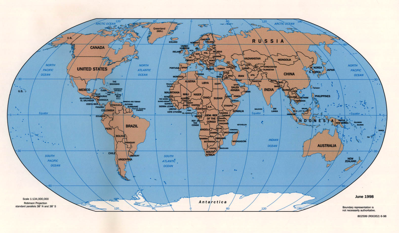
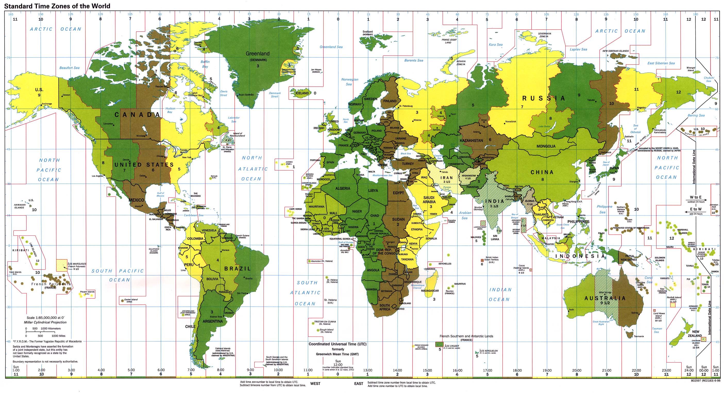
- Standard Time Zones of the World 1998 (774K) [jpeg format]
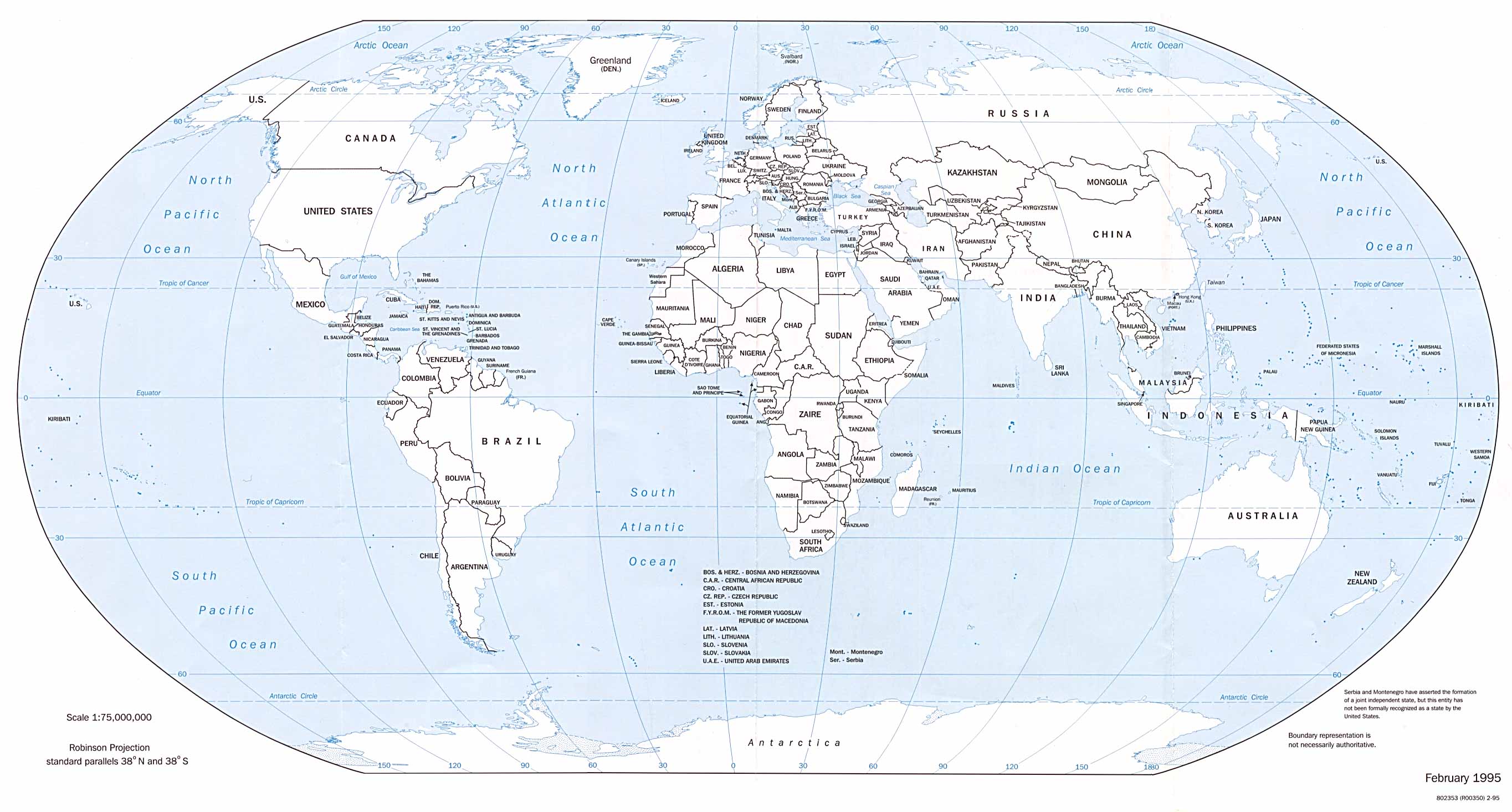
- Standard Time Zones of the World 1995 (593K) [jpeg format]
- Standard Time Zones of the World 2001 (1.6MB) [pdf format]
- Standard Time Zones of the World 2000 (1.2MB) [pdf format]
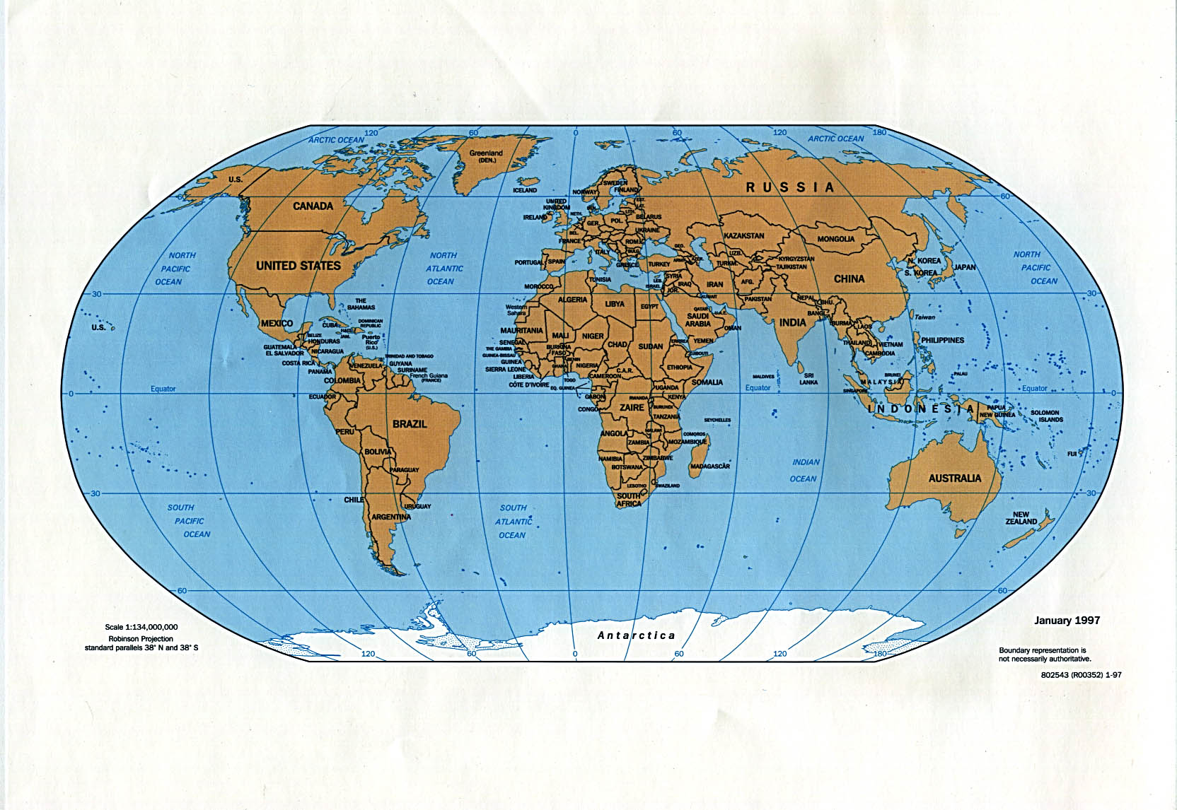
- Standard Time Zones of the World 1999 (2.1MB) [pdf format]
- Standard Time Zones of the World 1997 (2.6MB) [pdf format]
- United States Foreign Service Posts September 2011 (13.7MB) [pdf format]
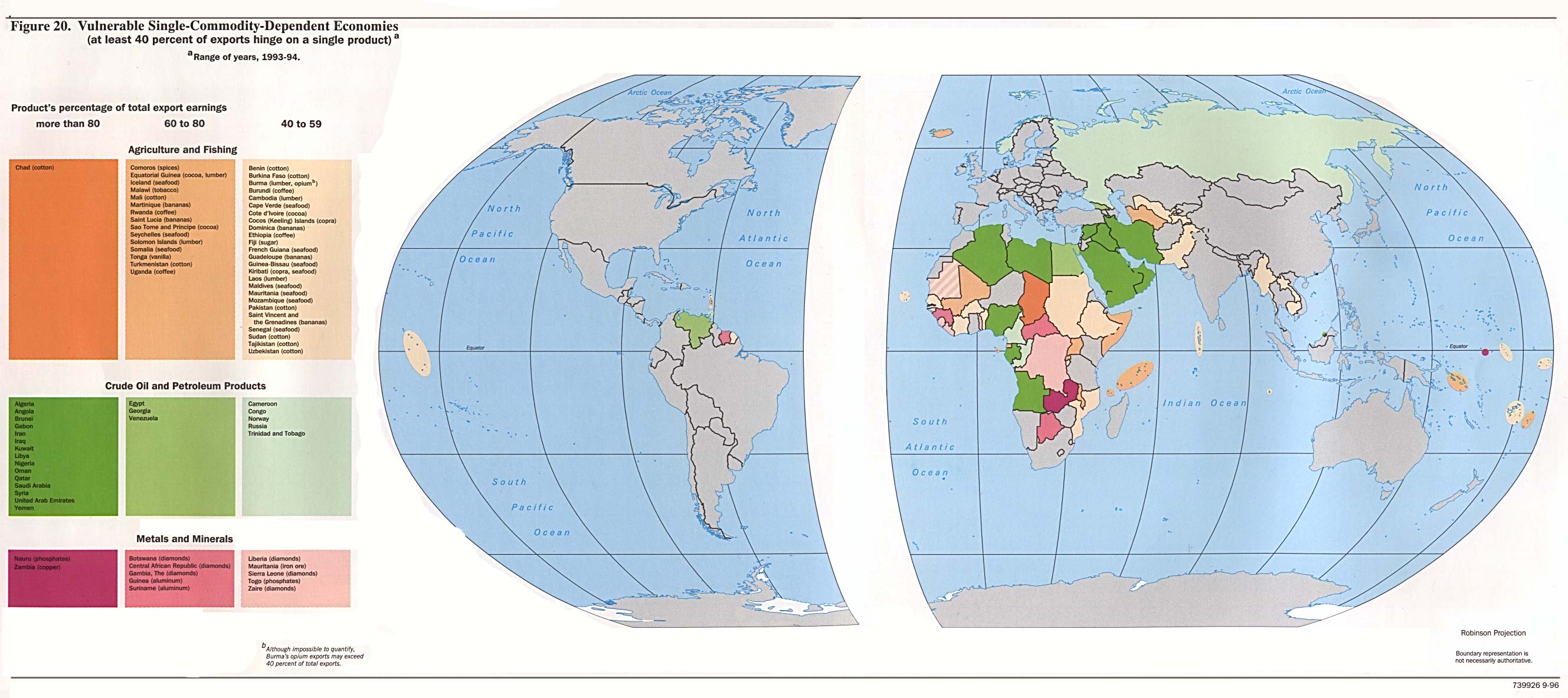
- Vulnerable Single-Commodity-Dependent Economies from Handbook of International Economic Statistics. 1996 (390K)
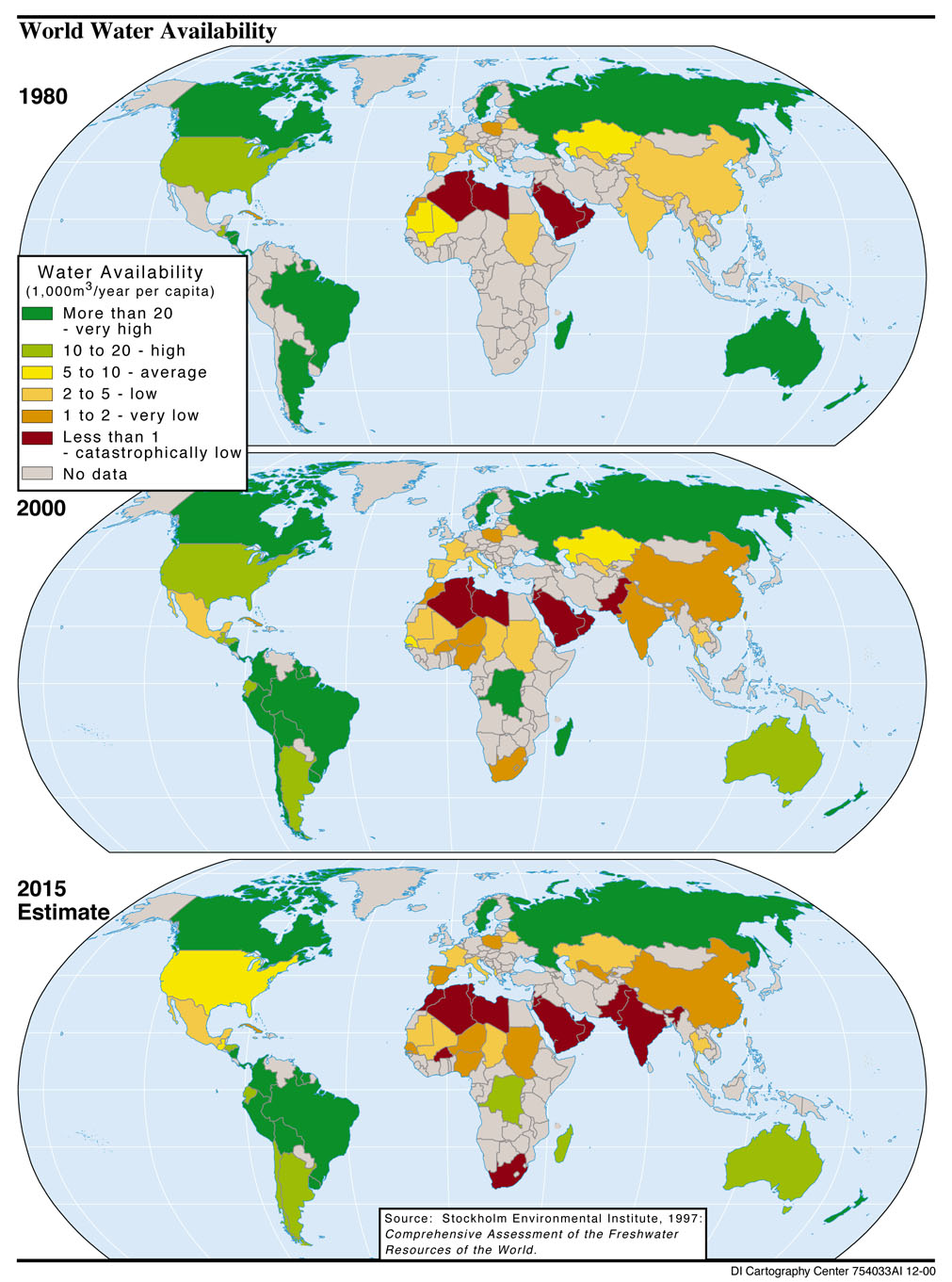
- Water Availability 1980-2015 from Global Trends 2015: A Dialogue About the Future With Nongovernment Experts [page 37], National Intelligence Council, 2000 (318K)
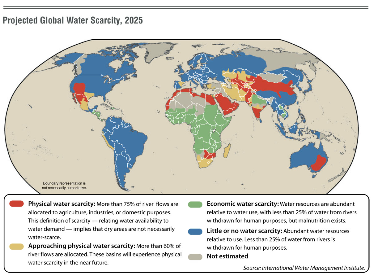
- Water Scarcity 2025 from Global Trends 2025: A Transformed World [page 75], National Intelligence Council, 2008 (258K)
- World Aeronautical Charts
- World City Maps (University of Texas Map Collection)
- World City Maps on Other Web Sites
- World Country Maps on Other Web Sites
- World Country Maps (Small Maps) from The World Factbook, published by the U.S. Central Intelligence Agency: 2015 Maps and Maps for 1995-2015
- World Topographic Maps


